


Mojave Desert Peak #4 - Inspiration Peak
Explore Landscapes #42: Two strikes and finally a summit reached. Learning the hard way that I need to plan my desert hikes more carefully.
If you‘re new here, welcome. I’m a professional landscape photographer specializing in Joshua Tree National Park. My weekly Monday newsletter is typically a long-form ‘teaching’ article for paid subscribers and workshop attendees. My free Thursday newsletter should interest a wider audience and is typically about my hiking, volunteering, or workshop adventures. I look forward to helping you improve your photography!
I’m behind on my plan to hike a Mojave Desert Peak each month this year. It’s approaching the end of June, so I should have six now. But alas, until this past Sunday, I struck out twice (and failed to summit), and to use a baseball term, I was not willing to get three strikes and be out!
Hiking in the desert can be very challenging, particularly if you fail to plan adequately, and you have to know when to quit and say not today!
In May, we attempted to hike up Quail Mountain - the tallest named peak in Joshua Tree National Park at 5,816 feet (1,772 m) - and I’d ‘overlooked’ that to get to the summit, we’d need to hike cross-country and gain 1,200 feet over difficult terrain without any trail. That left me feeling pretty stupid.
I attempted to hike up Mount Minerva Hoyt this past Saturday with a friend. To avoid the heat, we set off late in the day; however, I misinterpreted the route description, and the 4-mile out-and-back was actually an 8-mile out-and-back. This would have been OK, but the hike to the peak was, again, cross-country - i.e., no trail and some scrambling - which slowed us down considerably. As ‘the better part of valor is discretion‘ (Falstaff in Shakespeare’s Henry IV), we turned around less than a mile and 800 feet from the summit to get back to level ground before dark.
This post is a bit on the long side, and Substack is telling me it may get truncated when delivered to your email inbox. If so, please click ‘View in browser’ at the top right of the email.
After chastising myself appropriately, I woke up early on Sunday morning, determined to reach the top of a Mojave Desert Peak. At this time of year, it’s typically 90°F by 9 a.m., so I needed to find a short hike that I could complete before the heat of the day.
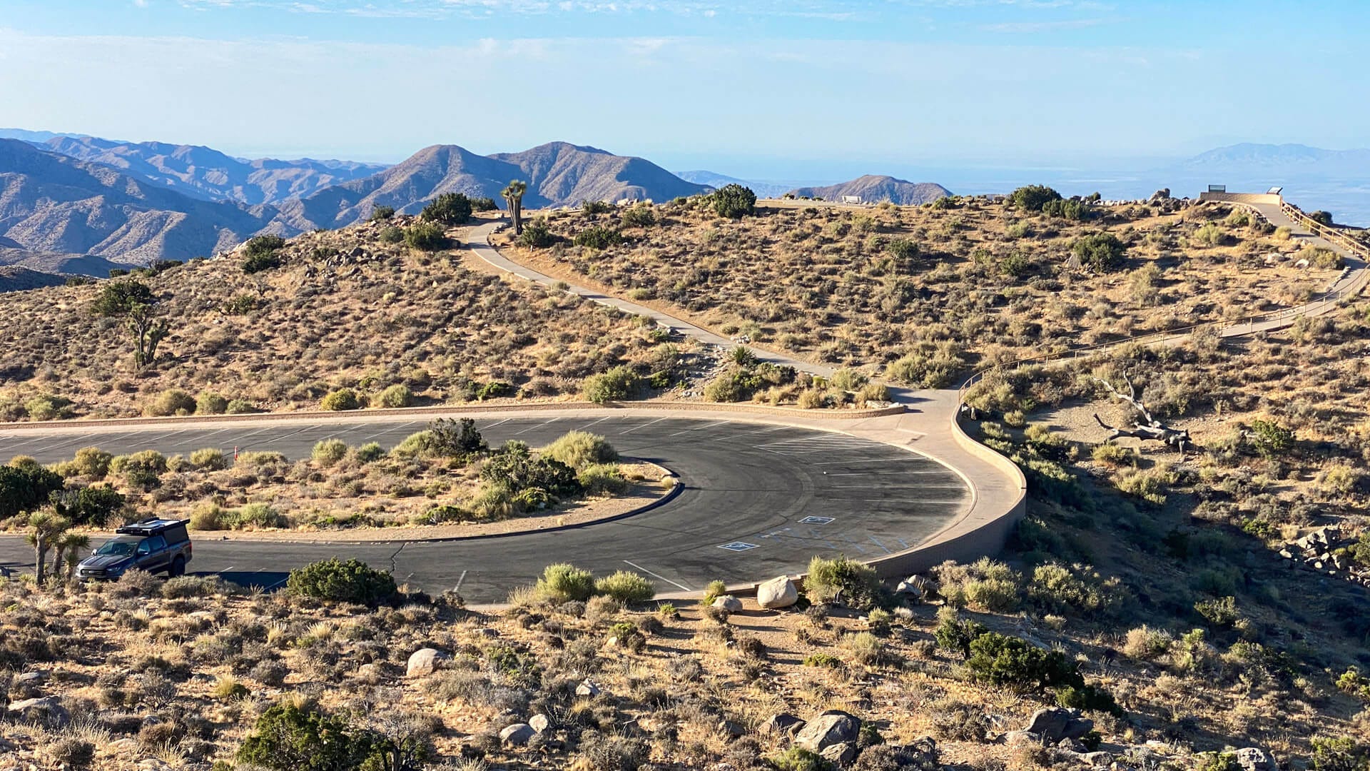
I’d already scoped out this hike (and yes, double-checked the distance and made sure that there was, in fact, a trail). I got to the trailhead at Keys View nice and early (just before 7 a.m.), so early that I was the only person in the parking lot.
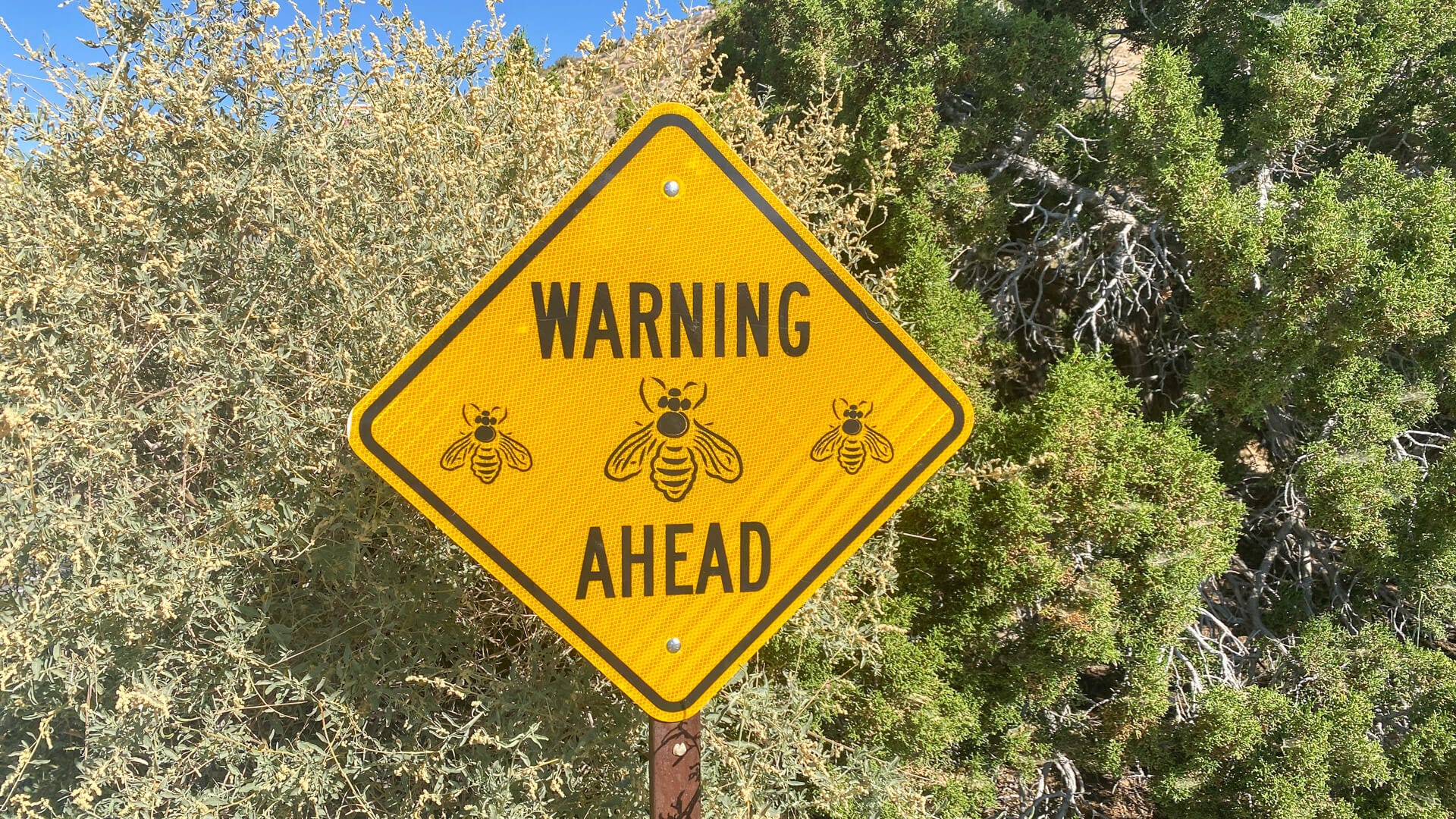
A couple of locations in the park have a bee problem during the summer months - and this is one of them. The bees are desperate for any moisture they can find on your person and are determined to get close to you. They quite literally make a beeline for you. I didn’t waste any time getting onto the trail and hiking uphill away from the bees.
This is a short hike (less than 2 miles in total) with just 400 feet of elevation gain, so it was perfect for hiking first thing before the heat of the day set in. The trail up from the parking lot was covered in knee-high Desert Chia, an annual plant with a lovely, strong, minty aroma.
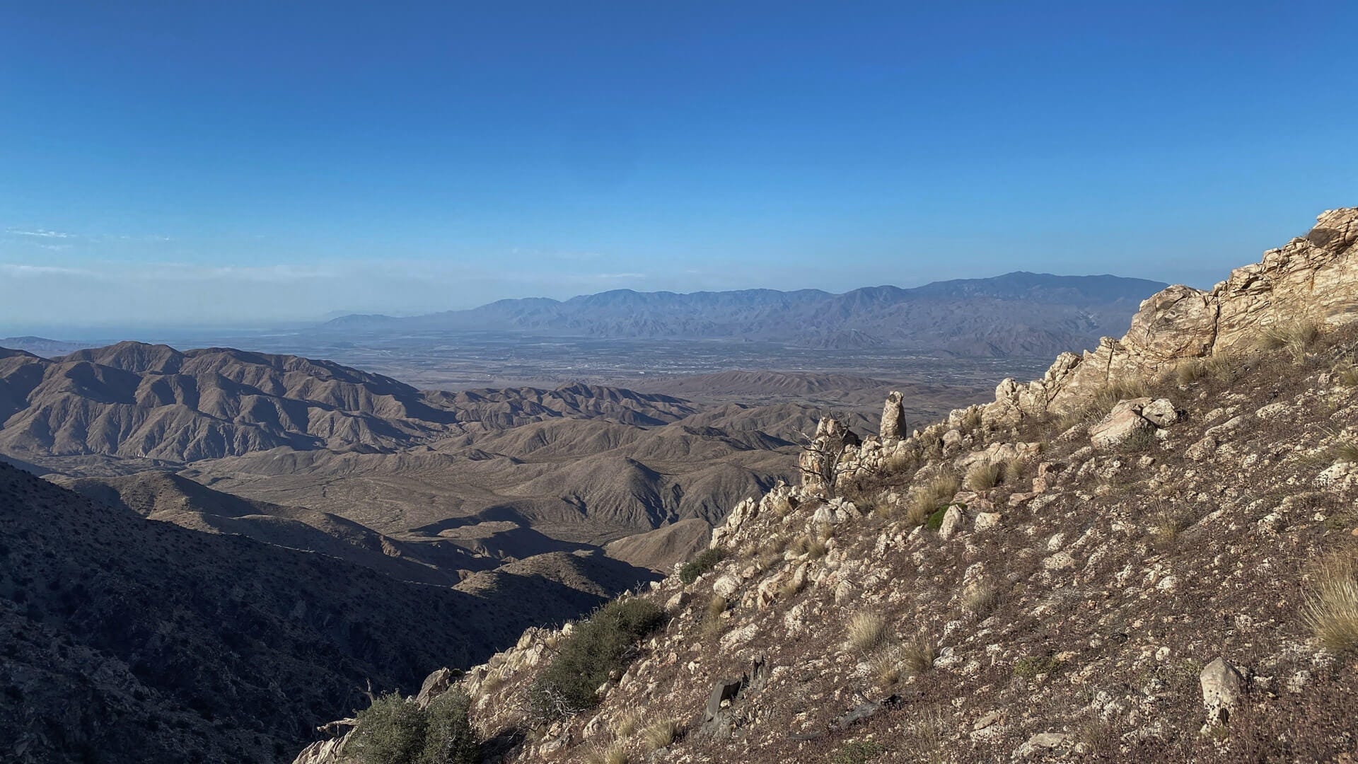
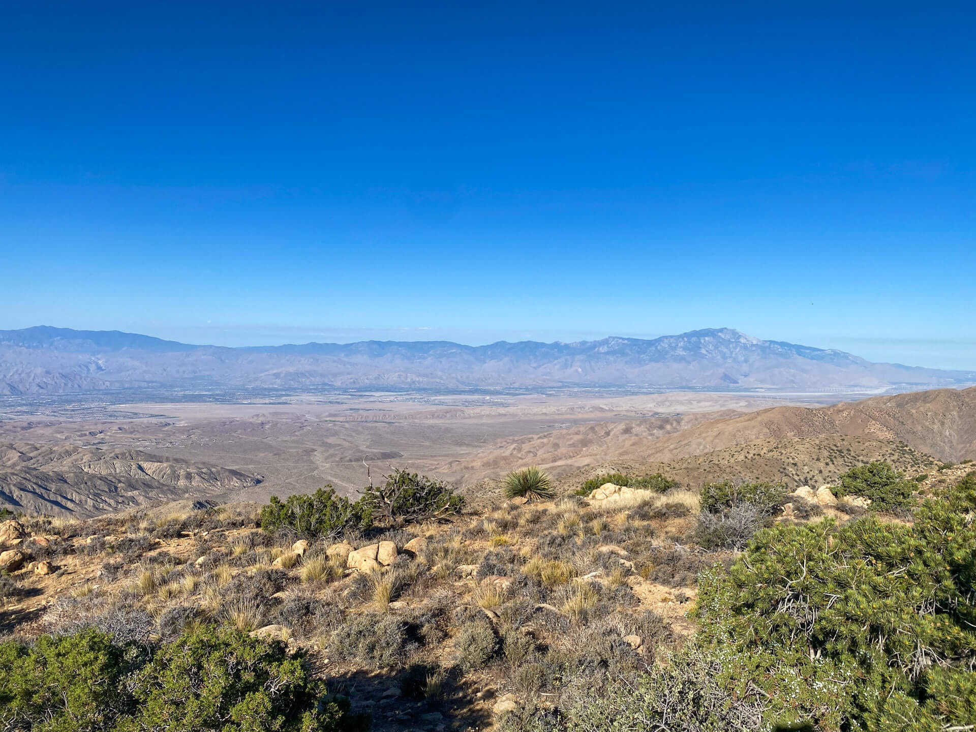
The views across and down the Coachella Valley improve as you ascend the slope from the Keys View parking lot. From this vantage point, you can clearly see the sawtooth geometry of the San Andreas fault lines that run along the valley.
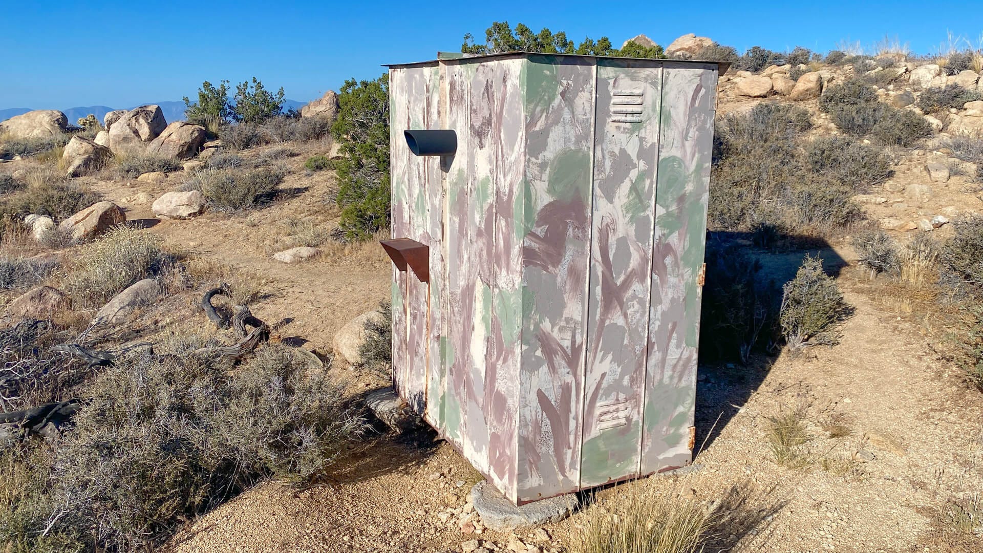
I came across what appeared to be a camera installation in a pseudo-camouflaged metal hut bearing a ‘US Government Property No Trespassing’ sign. I double-checked the Joshua Tree NP website, but there’s no publicly visible webcam listed for this location. So maybe someone somewhere was surprised when I looked down each of the two lenses in turn.
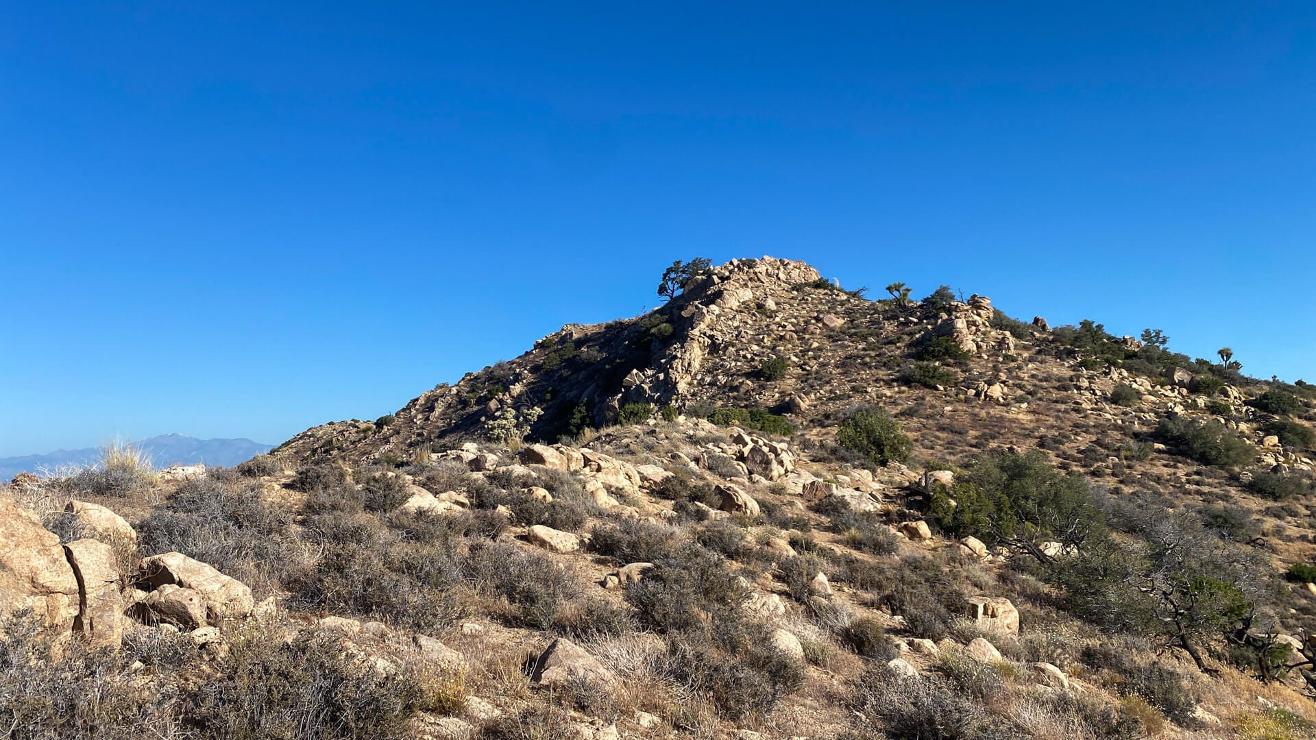
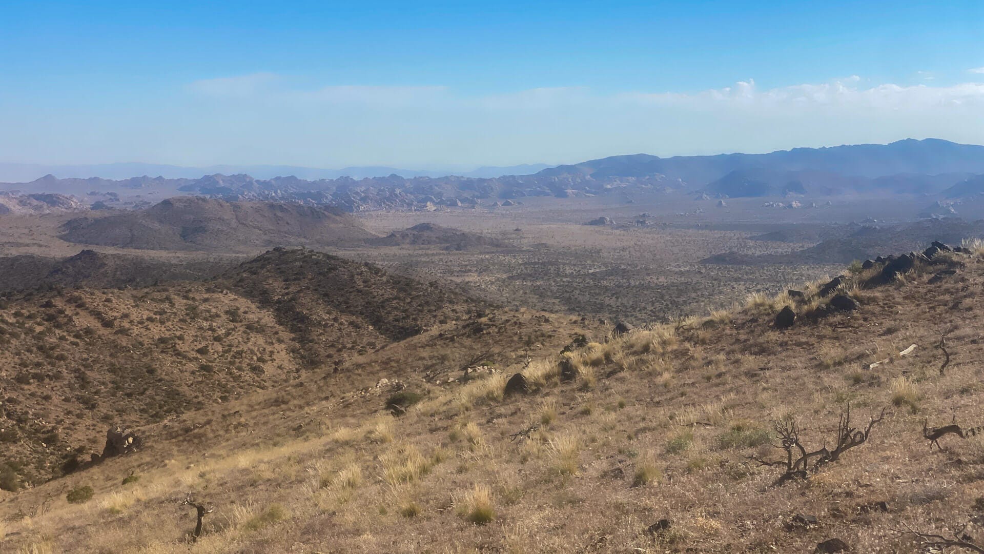
The actual peak lies beyond a false peak, and with just another fifty feet uphill, I was at the top. It was a beautiful, clear morning, and the views from the top were stunning. I didn’t see another person for the duration of my hike. It’s always such a lovely experience to have a little slice of nature all to yourself - if only for a short time.
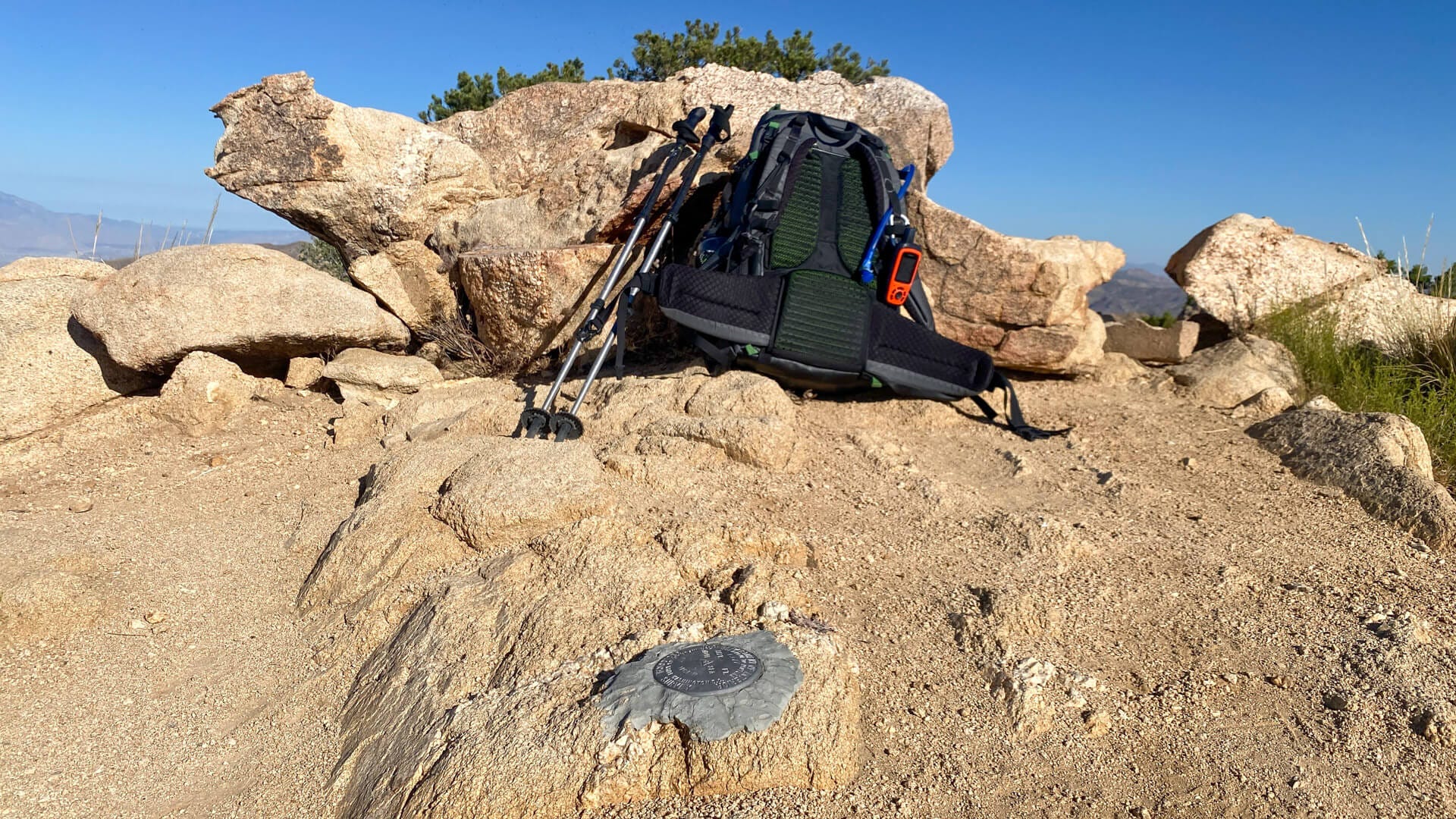
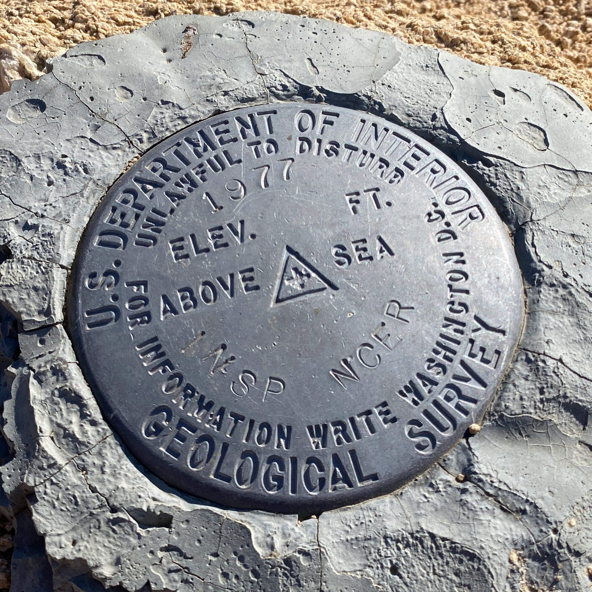
It would appear that this particular geological survey marker had no great consequence as the elevation was not added. I’m assuming that 1977 was the year the marker was installed - as the peak’s at 5,541 feet.
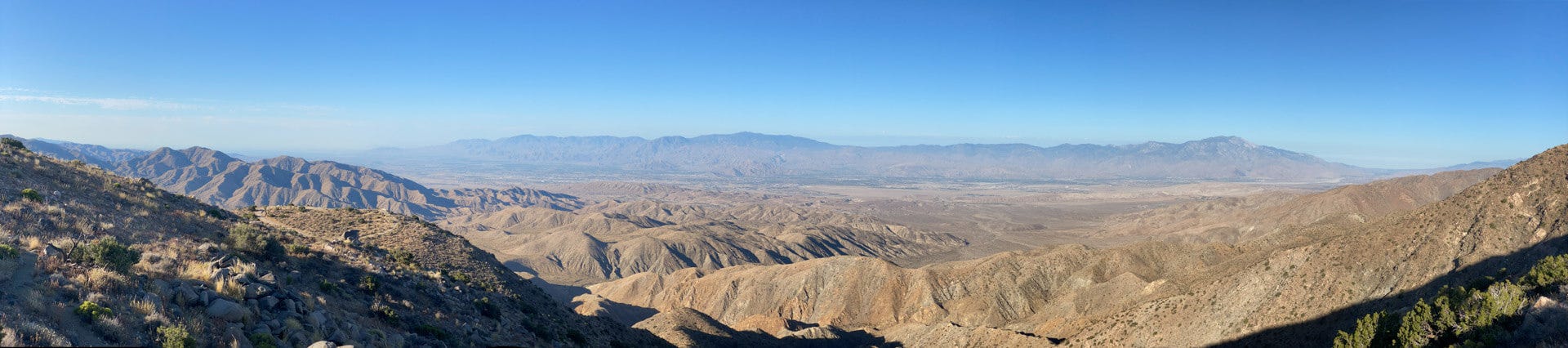
I enjoyed some time at the summit, taking in the view and shooting a quick panorama on my iPhone. Several peaks in Joshua Tree have summit log books, so visitors can leave a quick comment. I wrote a message to my Mum. I always feel closer to her at the top of a mountain.
After a good thirty minutes on the summit (which sounds a bit grand for this particular location), I started back down before it got too hot. There was a great view (to the North) of the Wonderland of Rocks and (to the East) of Ryan Mountain.
I was back in the game. Now, I need to plan for Mojave Desert Peak #5.

What to expect next week:
On Monday, paid subscribers will receive a post from me on Light and Exposure
Next Thursday, all subscribers will get my One Month - One Picture post for June
Let me be your landscape photography guide to Joshua Tree National Park
My workshops cater to all levels of photographers and include classic viewpoints and hidden gems. I'll ensure you're in the best place to take advantage of the light and weather conditions.
You can choose a one-to-one workshop (and personalize it to what you'd like to photograph, specific techniques, or how far you want to hike) or join a small group workshop (limited to 3 photographers).
Stay for a weekend and immerse yourself in the majesty of the Mojave on a landscape photography retreat in Joshua Tree National Park.
Here are a few of my posts that you might be interested in reading:


Interesting musings, images, and art from others:
Is the Forest Service Double-Dipping on Permits? by Casey Schreiner
Essential adventure gear: my hardest working items by Jenn Woltjen
Why Travel and Adventure are Existential Concerns by Justin S. Bailey
Letter From the Desert: Catching Up by Chris Clarke
#cloudphotography by Rachel Jeffrey
∴Complexion∴ by Chris Da Canha
☼Waves☼ by Steven Thomas
Edward Weston by Neil Scott
A Scenic Journey Along Highway One: Discovering the Charm of Cayucos, California by Benjamin Fargen
June in Bloom by Whitney Barkman
I love being the first parking my car at the start of a trail and I love even more if I have the trail all to myself. 🤣 This looks like a great hike.
Thank you for taking us along!
Cheers!