


Essential Landscape Photography Apps
Explore Landscapes #54: Today I'm sharing my 3 essential (and favorite) apps that I use before/during pretty much every landscape photography shoot.
If you‘re new here, welcome. I’m a professional landscape photographer and hiking/backpacking guide specializing in Joshua Tree National Park. My weekly Monday newsletter is typically a long-form ‘teaching’ article for paid subscribers and workshop attendees. My free Thursday newsletter should interest a wider audience and is typically about my hiking, volunteering, or workshop adventures.
Please subscribe to read more of my posts, visit my website to view my images, or book a workshop or mentoring session. If you value what I provide, consider becoming a paid subscriber or buying me a coffee instead. I look forward to helping you improve your photography!
We all have tens (maybe even hundreds) of very useful apps on our phones that we use for all manner of things. As they say, ‘There’s an app for that!’
I have three apps that I consider essential to my landscape photography practice. I typically use them both during my planning and pre-visualization of a shoot and while I’m shooting images.
My essential apps are:
PhotoPills is a photography planning app that assists with many different landscape photography subjects, including the Milky Way, Moon, Sunrise, Sunset, Star Trails, Meteor Showers, Solar Eclipse, Lunar Eclipse, and Time Lapse.
GAIA GPS is digital mapping, route creation, and recording software with maps for every type of adventure.
Astropheric provides advanced weather tools for professional astronomers and astrophotographers in the Continental US and Canada.
This post is a bit on the long side, and Substack is telling me it may get truncated when delivered to your email inbox. If so, please click ‘View in browser’ at the top right of the email.
All 3 apps are available for both Apple iOS and Android smartphones. GAIA GPS and Astropheric have web-based (browser) versions of their apps, making them powerful tools for planning on a larger screen at home.
GAIA GPS and PhotoPills also have the advantage of working offline. However, with GAIA GPS, you do need to download maps for offline use before heading off-grid.
I should point out that there are many other apps that perform similar functions to the three I’ve highlighted, but I’ve used these apps for a good few years and rate them highly for what I need them to do. I’m not endorsed or sponsored by any of the app providers. But they’re on my essentials list.
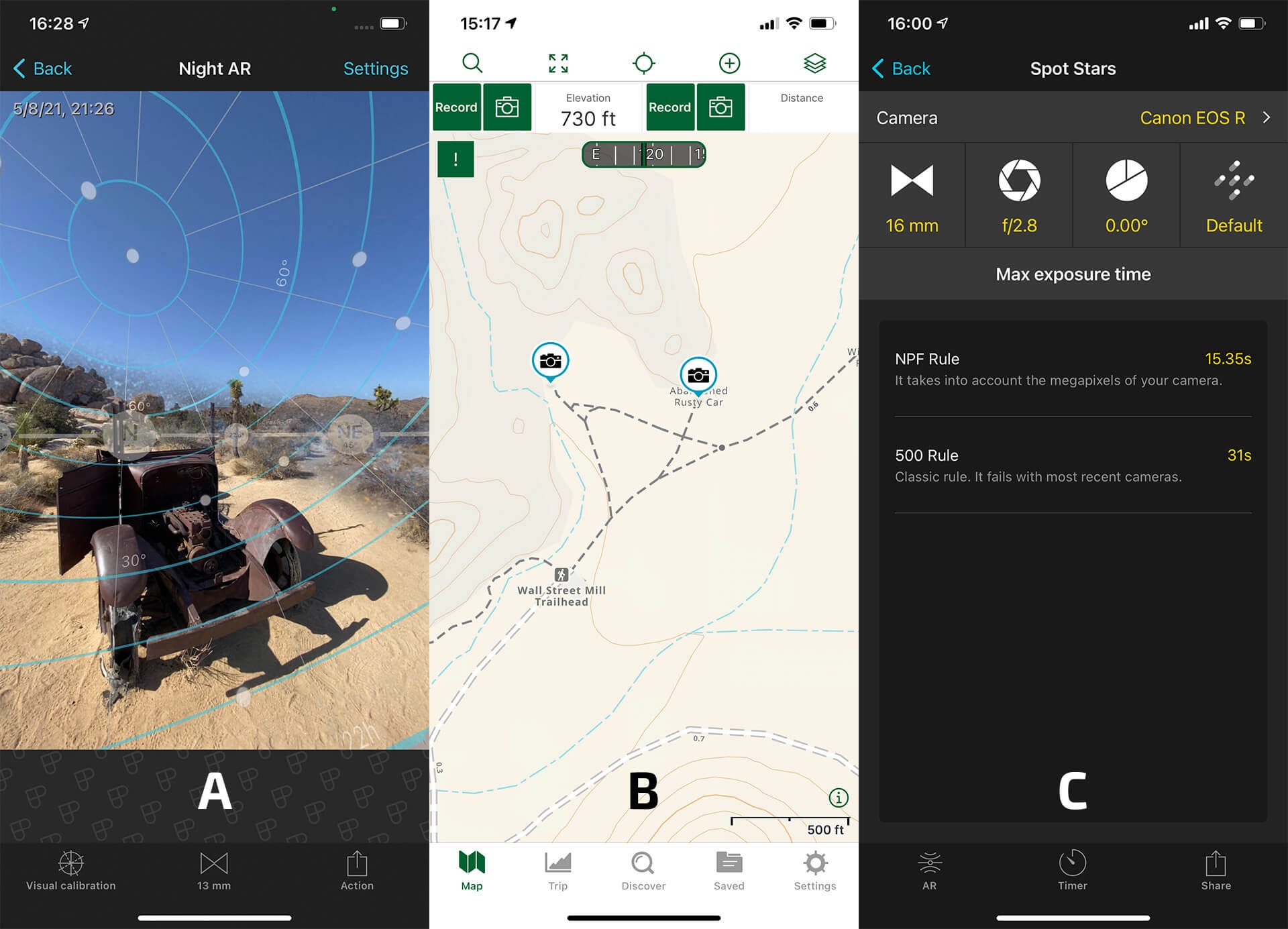
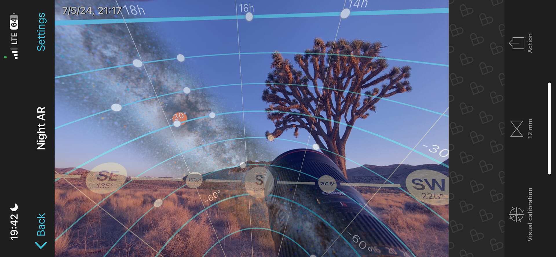
One of PhotoPills' most useful tools for Dark Sky Photography is Night AR (Night Augmented Reality). Planning and pre-visualizing your star trail shot during the daytime is essential unless you enjoy stumbling around in the dark, trying to find foreground elements, and then lining them up with Polaris (see post below for more info):

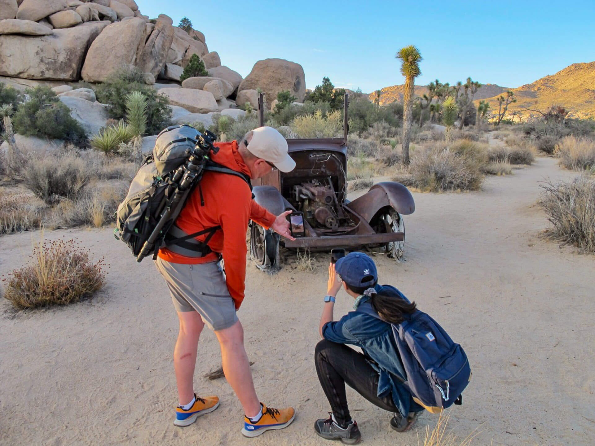
When scouting potential photo locations (not just for star trails but also for Milky Way images), I always take Night AR screenshots and drop a location pin in GAIA GPS. You may think you'll remember these locations, but if your memory is like mine, you may not.
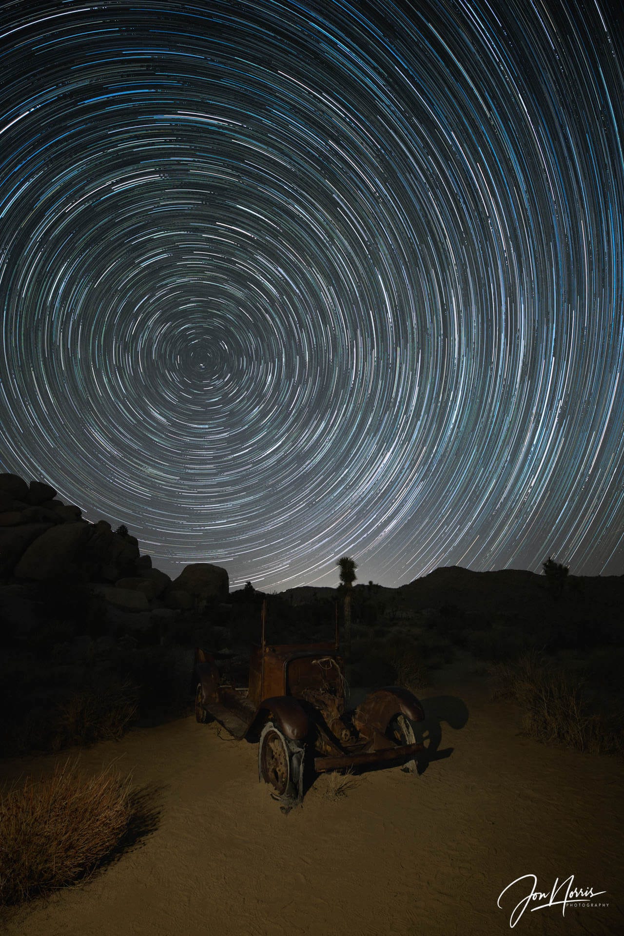
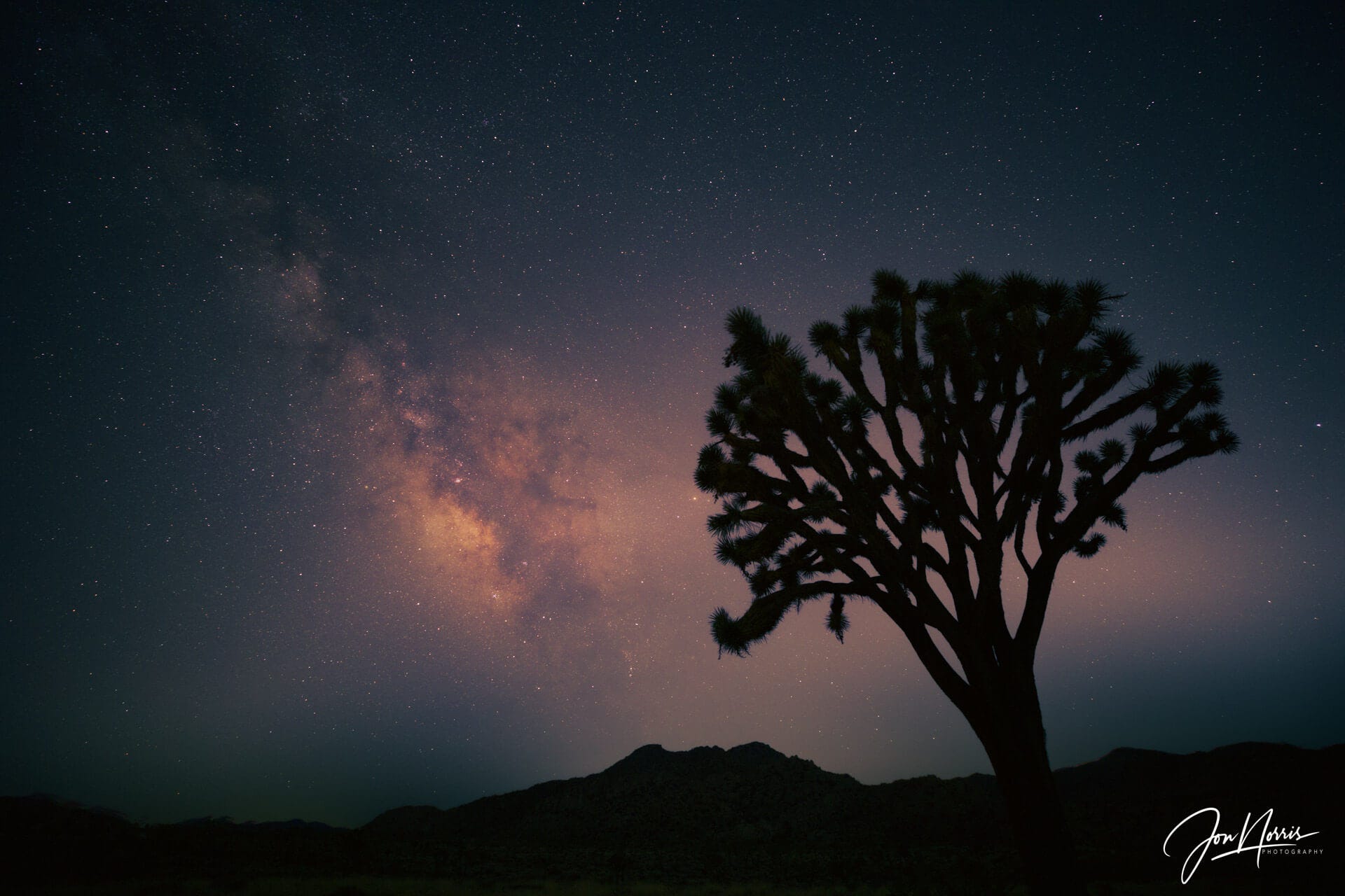
For my star trail images, I like to ensure that the stars are well-focused spots rather than softer, slightly stretched 'blobs' as the stars grow tails due to the Earth's rotation. To ensure this, it’s important that you select the correct shutter speed for your camera/lens combo to ensure spot stars in your images.
The easiest way to select the appropriate shutter speed is to use PhotoPills. Navigate to the Spot Stars section, choose your camera model, which in my case is the Canon EOS R (which sets the sensor resolution), and then select the focal length and aperture of the lens you're using. Under max exposure time, you'll see two different shutter speed values given: NPF Rule and 500 Rule. I typically use a shutter speed close to the NPF rule and faster than the 500 Rule value, resulting in the sharpest stars.
I use GAIA GPS as my map and navigation app for all of my hiking, backpacking, and photography scouting trips. I keep a record of all my tracks and also use it extensively to record waypoints as I scout to come back to later.
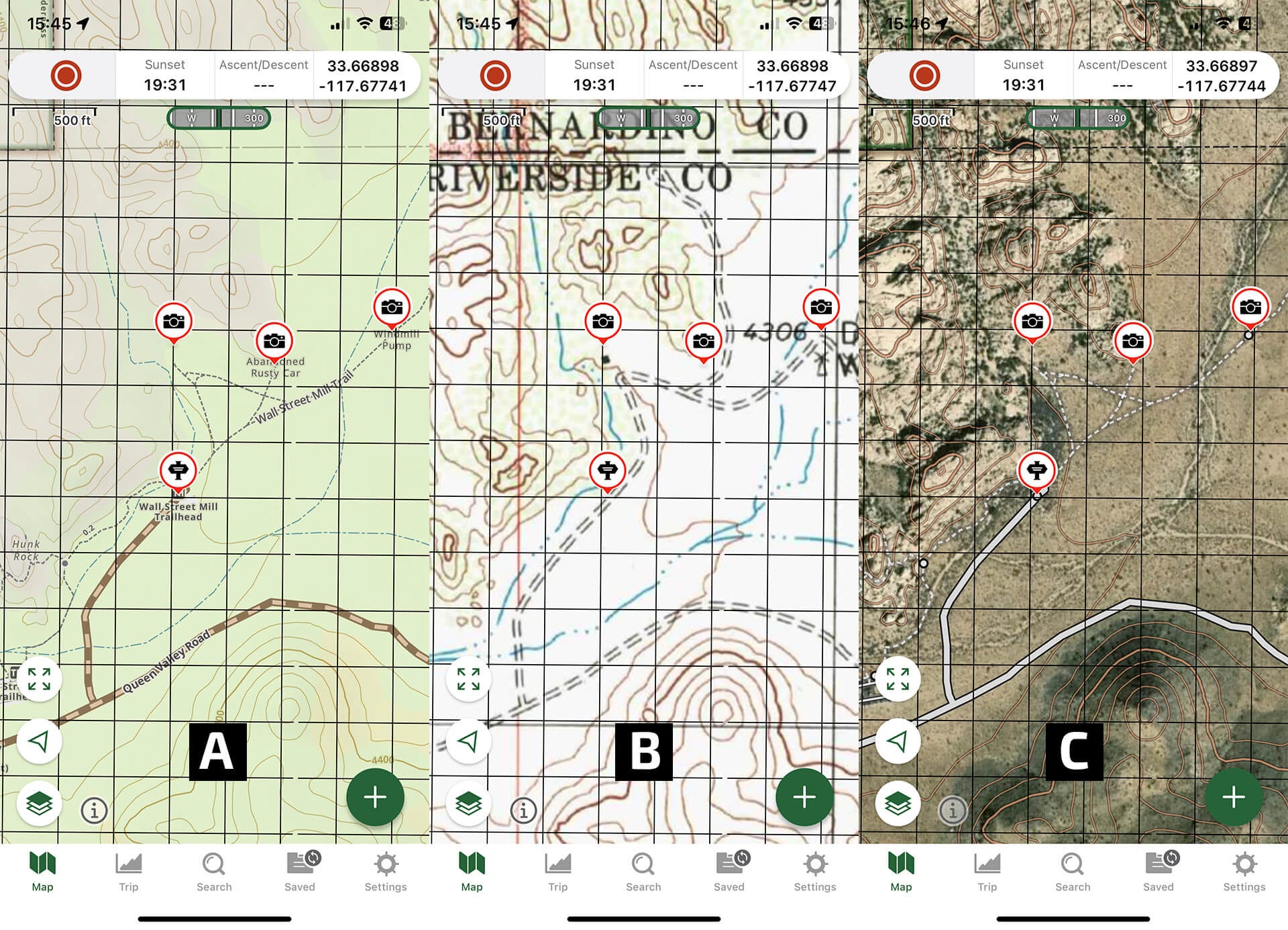
GAIA GPS features many map layers (if you opt for the premium license - which I would highly recommend). This allows you to fully customize the map as you want to see it.
I’ve found the most useful layers (for my landscape photography) to be Gaia Topo, Satellite Topo, Gaia Overland, USGS Topo, Public Land (US), and Light Pollution.
When I save maps for offline use, I save those 6 layers so that I can choose which to use in the field to suit what I’m doing and where I am.
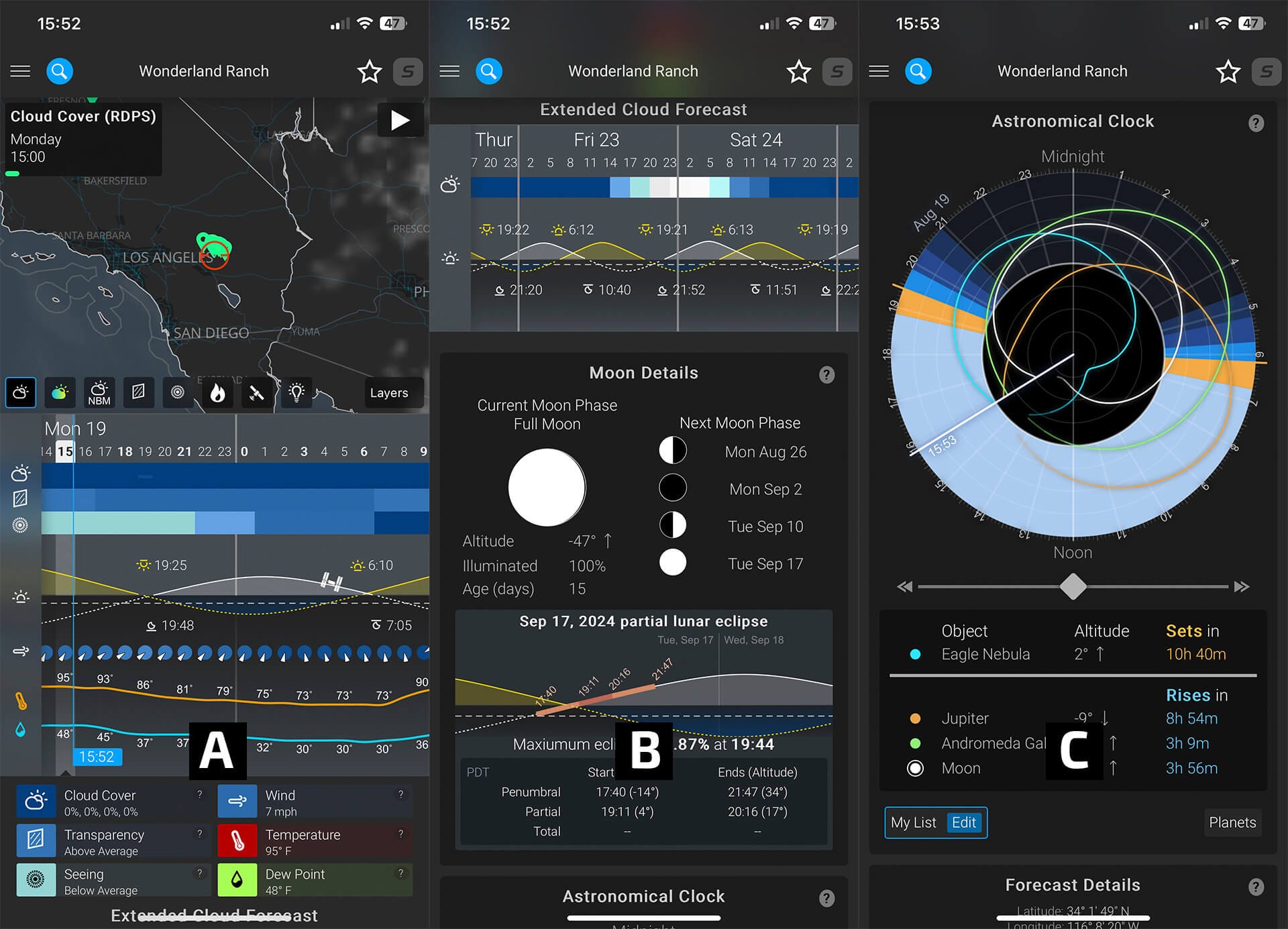
Like many photographers, I’ve tried various weather apps with varying success levels over the years. As I shoot a lot of dark sky photography, two of the most important weather items for me are the amount of cloud cover and the sky's transparency.
For several years, I used the app Dark Sky. However, Apple purchased it some time ago, and its functionality was brought into Apple’s native weather app.
Since then, I’ve been using Astropheric and am very happy with its performance. I typically only use the first page of the forecast (which shows the map, cloud cover, transparency, seeing, etc.). One of its strengths is that it averages four different cloud cover models - which I’ve found to be fairly accurate.
However, please remember that Astropheric does not work offline. If you want to see the forecasts in the field, you’ll need to take screenshots, but of course, these will not be up to date.
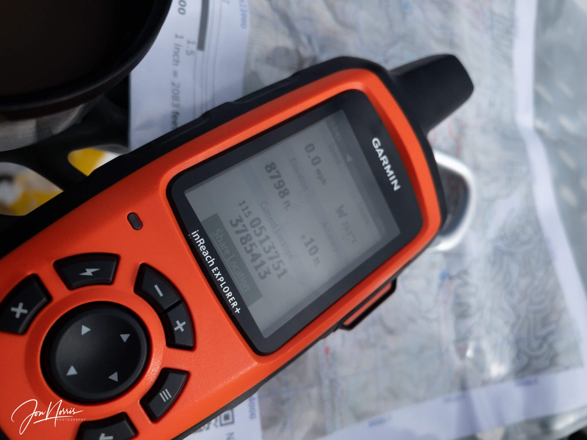
For that reason, to get up-to-date weather forecasts while I’m in the field, I rely on my trusty inReach EXPLORER+, which can receive detailed weather reports for my specific location over GPS.
I’ve only scratched the surface of what these apps can do to support your photography and time out in the wilderness. I encourage you to do your homework, try out a few apps, and see what they can do to save you time and/or improve your photography.
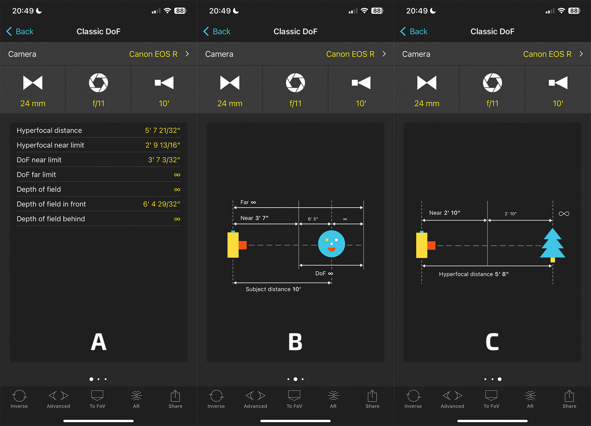
For example, PhotoPills provides an excellent interface to help you understand and calculate the depth of field and hyperfocal distance when out in the field. See the article below for more info:

I’d love to know what apps you use to support your photography. Please do drop me a line if you think I’m missing a trick, or if you’ve found the next best app!

Join me in Joshua Tree National Park to learn how to shoot the Milky Way and Star Trails on one of these upcoming JTNPA field workshops.
Take a look at the wonderfully illustrated Desert Institute Fall Field Guide for this and other field classes. You can book your place via the Desert Institute Humanitix page.
Here are a few of my posts that you might be interested in reading:


Interesting musings, images, and art from others:
The Definition of Landscape Photography by Gill Moon Photography
Photography is many things to me by Joe Callender
Exciting Finds From A Recent Photo Trip by Kyle McDougall
From Codependency to Companionship by Jen Hitze
Hotspots by Jacob Clarke
Lines, Lines, and More Lines by Donn Dobkin
The path by PerfectLight
The Last Survivors of an Atomic Bomb by Andy Adams
Spirit Photography by Susanne Helmert
This is what happens after rain: temporary treasure by Michela Griffith